Environmental Justice
This initiative aims to understand designs that have shaped our land. Chicago’s history is full of planning decisions that have created the deep inequities in our environment; beginning with settler colonialism that seized land and waterways from Indigenous peoples through violence and coercion. Because this history is so complex, we will not endeavor a comprehensive account here, though there are many projects that take on these issues (some of which are linked in our resources page). Here we will focus on a basic account of how environmental racism is made possible by the segregation in our cities, which has been intentionally designed and reinforced by our infrastructure.
The effects of pollution and climate change are not distributed equally across Chicago. Black and brown neighborhoods are far more likely to be located near industrial polluters. Housing discrimination has given people few options, and created pockets of the city that are politically disenfranchised and vulnerable to development and industries that expel pollutants which have disastrous health effects for nearby residents and are tied to increased rates in asthma, heart disease, and cancer.

Redlining map from 1939-40
The New Deal created the Home Owners’ Loan Corporation, a program to make home-ownership affordable for the middle class. Mortgage assessors were charged with maintaining segregation, and assigned risk of value depreciation based on the racial makeup of the area. They created color-coded maps where areas of the city where Black people lived were indicated in red to indicate high levels of risk, making them ineligible for most mortgages.
HOLC deemed red areas as “hazardous” and recommended lenders refuse loans in those areas.
(Source: Mapping Inequality)

Chicago Highway Plan from 1943
The highway system further reinforced segregation by displacing Black residents, acting as a physical barrier between Black and white neighborhoods, and encouraging white flight to the suburbs.
(Source: Medium)

Chicago Racial Demographics in 2000
As a direct result of these (and other) efforts, Chicago remains among the most segregated cities in the US. Demographic map shows that segregation in Chicago falls closely to the original Redlining maps
(Source: Radical Cartography).
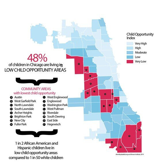
Opportunity Index Report
City investment favors white neighborhoods, creating massive disparities in opportunity and placing undue burden on communities of color. The opportunity gap in Chicago uses data from a public health department report to show the disparity in investment and opportunity that exists between predominantly Black and white neighborhoods.
(Source: The Chicago Reader).

Elevated Blood Levels
Lead levels in the water supply are significantly higher in Black and Brown neighborhoods. Elevated lead lead levels are particularly dangerous for children and can lead to symptoms like developmental delays, weight loss, fatigue, and learning difficulties.
(Source: Chicago Department of Public Health)
Pollution Burden Visualization
The burden of pollution is concentrated in Chicago’s Black and Brown neighborhoods. Red areas marked on the map have the greatest concentrations of air, water, and land pollution.
(Source: Better Government Association).

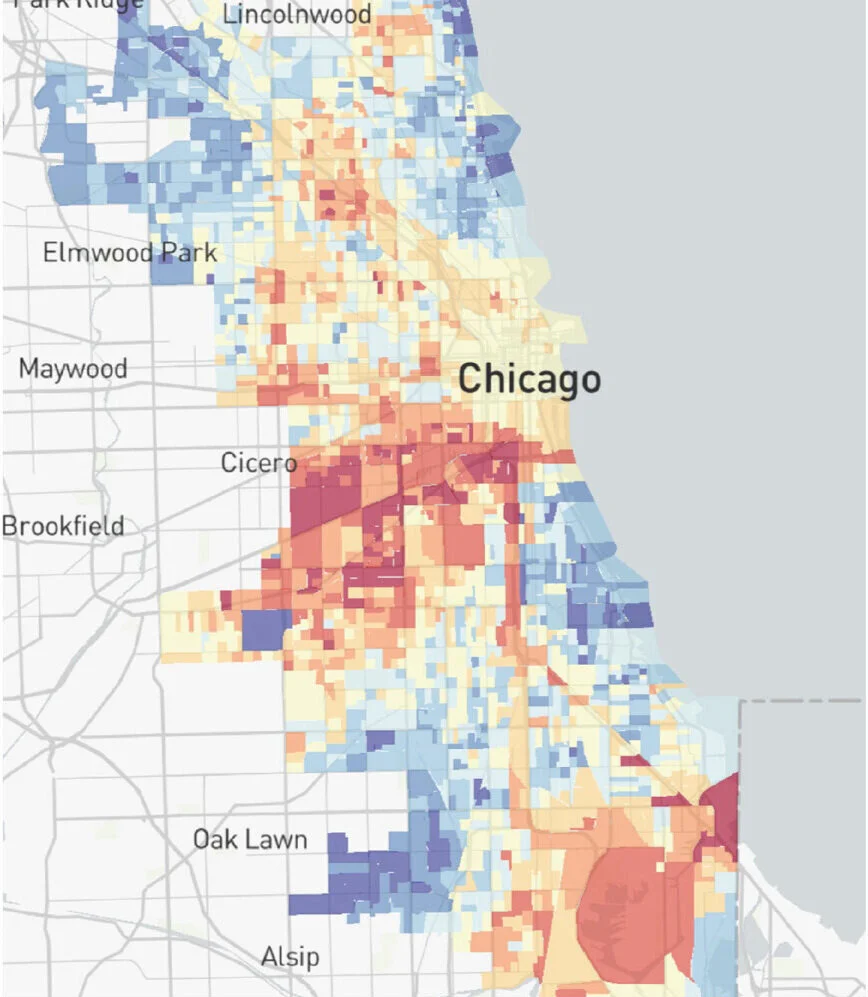
Life Expectancy
Environmental factors contribute to the dramatic difference in life expectancy rates, though there are many other factors at play including healthcare access, relative income, and disinvestment. In extreme cases there is a 30 year difference between white neighborhoods on the North side, and primarily Black neighborhoods on the South and West sides.
(Source: WTTW Chicago via Citylab).
“Cities have the capability of providing something for everybody, only because, and only when, they are created by everybody.”
— Jane Jacobs
Activist Spotlight
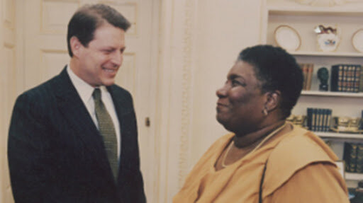
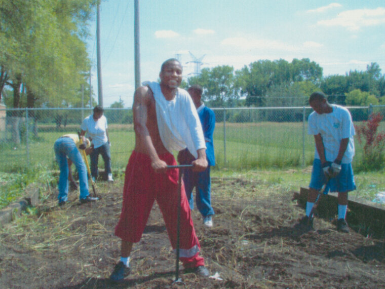
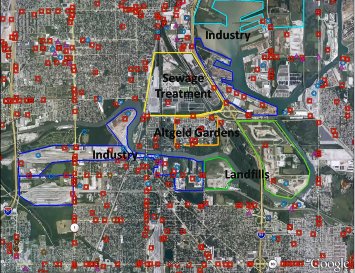
People for Community Recovery is a grassroots organization focused on community health and environmental Justice. It is the first Black led environmental justice organization in the midwest. PCR was founded by Hazel Johnson, commonly referred to as the mother of the environmental justice movement. Hazel Johnson moved from Louisiana to Altgeld Gardens in the 60s, but quickly became troubled by the number of deaths from cancer and other chronic health issues among her community. She discovered that the pattern of health problems in her neighborhood was directly correlated to the industrial facilities that surrounded Altgeld Gardens like a doughnut. In the 70s she began organizing her neighbors and educating her community about the harm from industrial pollutants, officially founding PCR in 1979. The organization worked to advocate for legislation, shut down incinerators, rallied residents to block landfills, and ensured asbestos was removed from public housing units. Even beyond this environmental advocacy, PCR educated residents about these dangers while creating a support network that provided health screenings and job training programs.
People for Community Recovers continues this vital work under the leadership of Hazel Johnson’s daughter, Cheryl Johnson. Learn more about their toxic tours, environmental justice programs, housing rights advocacy, and community development projects here. You can even go on a virtual toxic tour here.
A discussion of sustainable housing in Chicago. Featured speakers include preservationist Bob Remer of the Edgewater Historical Society, affordable housing advocate Noah Moskowitz of ONE Northside, and environmental justice leader Cheryl Johnson of People for Community Recovery, as well as George Tully of @properties, Anne Nicklin of Evanston Rebuilding Warehouse, and Mario Machnicki of Marion Construction.
Research assembled by Kait Roelofs